Russell Goebel
Home
About
Writing
Slides
fastblm and spatintegrate
Portfolio
CV
Writing
A kriging competition
A survey of scalable Gaussian process methods, organized around the Heaton et al. (2019) comparison paper.
May 19, 2026
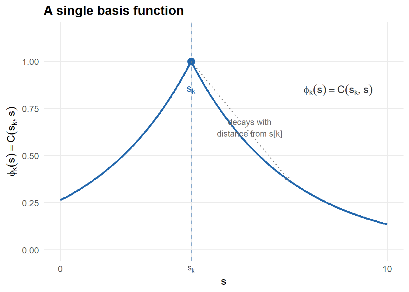
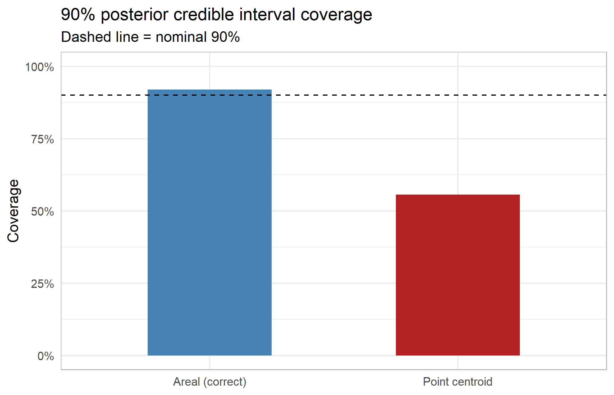
Area-to-area kriging with basis functions
Satellite observations are areal averages, not point measurements. Basis function methods reduce the intractable double-integral problem of area-to-area kriging to a single pass of cheap single integrals — provided the prior is chosen cleverly.
May 17, 2026
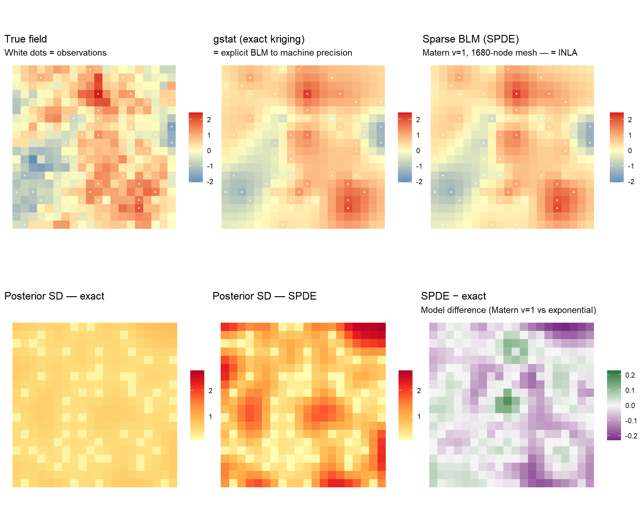
Kriging is Bayesian Linear Regression
A unified view of kriging, GP regression, and spatial basis function methods
May 6, 2026
No matching items